NOAA predictions
Tide heights come from the NOAA CO-OPS prediction service for US stations, on the MLLW datum, in local station time. Search by name or station ID.
 Tide Chart
One filled curve across the whole screen, a marker on now, and the water level set in the biggest type on the phone. Readable in half a second, in bright sun, on a moving boat.
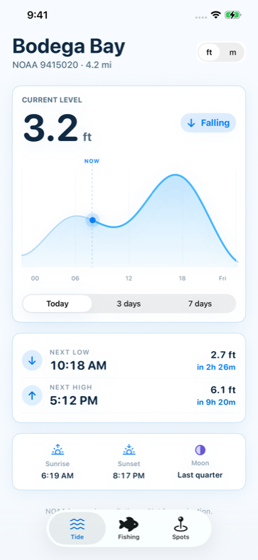
Anglers waiting on the turn, surfers reading the push, clammers chasing a minus tide, and boaters who need the depth under the keel.
Tide heights come from the NOAA CO-OPS prediction service for US stations, on the MLLW datum, in local station time. Search by name or station ID.
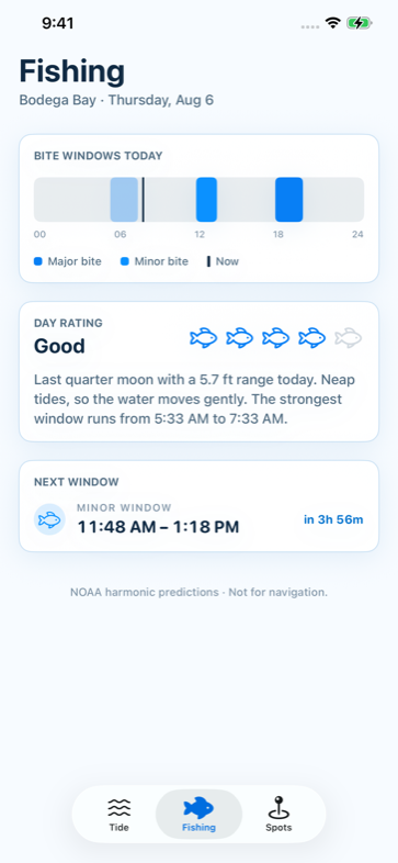
A 24-hour bar with major and minor solunar windows, derived from moon transit and the tide turn times, plus a rating for the day ahead.
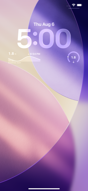
Countdown to the next turn, the current level, and today's curve — on the lock screen and the home screen, without opening the app.
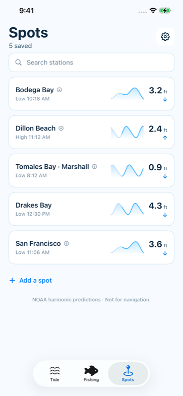
Start from the stations nearest you, then save the places you actually fish or paddle. Each one shows the level, a sparkline of today's curve, and the next turn.
Predictions are cached on the device, so the last forecast stays readable when the bars drop off in a cove or out past the point.
Get a heads-up before the tide turns — set the lead time once, and the reminder arrives for the spot you care about.
Light, clean and high contrast, so the curve stays readable in bright sun. Every number is tabular, so a ticking countdown never shuffles its own digits.
Tide heights are predictions published by the NOAA Center for Operational Oceanographic Products and Services (CO-OPS) for its US tide stations, referenced to the MLLW datum. Tide Chart is not affiliated with or endorsed by NOAA or the United States government.
Predictions are astronomical. They do not account for wind, barometric pressure, river discharge or storm surge, and the real water can sit well above or below the curve on any given day.
Tide Chart is not a navigation instrument. Do not use it for navigation, for clearance under a keel or a bridge, or for any decision where being wrong is dangerous. Use official charts and current notices to mariners.